
 Ethan B
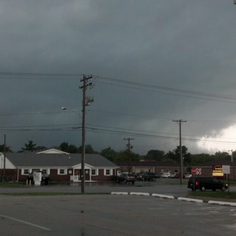
Getting video of weather and nature mostly from Indiana. I bring the camera, God brings the show.
My name is Ethan B and I'm a weather and nature videographer from Indiana, who is also a meteorology enthusiast! I currently participate in storm spotting and some chasing locally, but will be expending my range and increasing my chasing with time. I film severe weather, tornadoes, winter storms, natural areas, even some clouds that I find amazing! And more. I also update on noteworthy severe weather forecasts sometimes. Stay tuned for more videos in the future as I upload whenever the weather is interesting, and thank you for watching!
Ethan B
Hey guys! I hope to be getting some more chasing footage soon, severe weather hasn't been particularly active in Indiana lately. But while we're waiting, I wanted to ask you all a question: What do you think about my video quality?
I'm referring more to the actual resolution of the footage rather than the production itself. It may seem like a weird question, but in the age of 4K video coming out left and right, sometimes I worry that 1080p doesn't quite cut it. Could just be me randomly obsessing over small details, though Lol (I will also be upgrading to 4K at some point when I have more money).
July 18, 2025 1:15 AM EDT
2 months ago | [YT] | 4
View 2 replies
Ethan B
During the recent severe weather in the region, storm chasers @xamiHD and @jamestreft5570 had a successful chase including INTENSE damaging winds and a tornado! Go check them out!
3 months ago | [YT] | 4
View 0 replies
Ethan B
DON'T MISS IT: NEW CHASING FOOTAGE COMING AT 4:00 PM EDT TODAY!
I managed to chase some amazing and largely unexpected storms in Indiana yesterday, including a beautiful mini supercell and a particularly amazing shelf cloud. It was even more successful than June 18th, so be sure to give it a watch later today! The video is scheduled to become public at 4:00 PM EDT/3:00 PM CDT.
June 20, 2025 4:50 AM EDT
3 months ago | [YT] | 4
View 0 replies
Ethan B
SUCCESS!
If you haven't seen it already, go check out my direct intercept of a derecho-producing storm over northern Indiana from Wednesday! It was a pretty fun chase and some nice wind.
June 20, 2025 4:45 AM EDT
3 months ago | [YT] | 1
View 0 replies
Ethan B
June 18, 2025 3:00 AM EDT
Hey guys! After a painfully long lull in severe weather activity around Indiana, things are picking back up. Later today, a remnant MCV is going to move into central IL and help to initiate severe thunderstorms over the region. Moderate to strong buoyancy will be in place downstream over IN, and with the enhanced shear profile generated by the low, all severe weather hazards are possible. It remains possible that a localized tornado event occurs ahead of the MCV, which could extend into portions of eastern IL and northern IN. Greater confidence exists in the potential for damaging winds, however, as storms grow upscale into a large linear complex. Will I manage to actually get a good storm? Stick around to find out!
3 months ago | [YT] | 9
View 0 replies
Ethan B
Although I recently missed out on the main show with the May 16, 2025 tornado outbreak, I did witness the GREATEST sunset mammatus clouds I've ever seen! I'm very thankful for all of the attention you've given this, as it has far-exceeded my expectations. Nature is absolutely captivating, and I'm glad to see so many enjoying it!
May 22, 2025 12:43 AM EDT
4 months ago | [YT] | 7
View 2 replies
Ethan B
Hey guys! I'm sorry it's been a long time. As you'll know if you follow me on Twitter/X at x.com/EthanB86419472 , the April 2, 2025 severe weather event didn't work out like I expected. And this was followed by a month and a half-long period of very inactive weather, where even thunderstorms were hard to come by. However, as we head into the second half of May, things are heating back up again in a big way. An extremely unstable environment is expected to form ahead of a dry line over IL tomorrow, with an unusually strong EML and high dew points at the sfc allowing for SBCAPE as high as 3,000-4,000 J/kg, maybe even higher. With a deep occluding low over the MN area, evening amplification of a LLJ will allow 0-1km SRH to ramp up substantially, with values of 200-300 m2/s2 amid largely streamwise hodographs. Deep-layer wind shear, aided by an approaching sub-tropical jet, is likely to be supportive of supercells, and with the robust instability, rapid and significant severe weather development appears probable over portions of NE IL/northern IN later today. Capping may be an initial concern, but 500 mlb heights should start to fall as the jet streak approaches, and convergence along the dry line should allow storms to fire in IL before spreading into IN. Hazards with supercells could be substantial, including very large hail and significant tornadoes. If a more clustered storm mode is realized (especially later and closer to the dry line after dark), significant damaging winds are also probable. This is a volatile setup with some lingering uncertainties, and I'm hoping to be able to get something!
May 15, 2025
3:30 AM EDT
4 months ago | [YT] | 8
View 0 replies
Ethan B
DANGEROUS SEVERE WEATHER RISK FOR INDIANA APRIL 2, 2025
There seems to be increasing confidence in significant instability developing into the area later this evening, yielding MLCAPE of up to 2,000 J/kg amid a potent LLJ. Because of the intensity of low-level flow (around 60 kts or so), effective SRH may amplify to values in excess of 400 m2/s2. The resulting parameter space, including STP for 4-6, is honestly the scariest severe weather threat I've seen in my area in years. If this pans out, it is possible that a tornado outbreak occurs in Indiana.
I'll do what I can to get footage, but given the potential density of storms, limitations to my vehicle attm, and the safety of my family, it could be a very difficult evening. Stay tuned!
Ethan B
April 2, 2025 11:45 AM EDT
6 months ago | [YT] | 6
View 2 replies
Ethan B
In case you missed it: Successful severe thunderstorm intercept during Indiana severe weather outbreak on March 30th!
6 months ago | [YT] | 4
View 0 replies
Ethan B
Widespread severe weather threat in Indiana today! A potential severe weather outbreak will yield a threat for widespread damaging winds, large hail, and some tornadoes from the Lower Great Lakes into the Ark-La-Tex region, encouraged by substantial destabilization ahead of a strong cold front.
Might have some footage come out of this! If you want to get more frequent updates on my experiences, be sure to follow me on X/Twitter if you haven't already: x.com/EthanB86419472
Thank you, and stay safe!
Ethan B
March 30, 2025 2:38 AM EDT
6 months ago | [YT] | 6
View 0 replies
Load more